ConnectGREEN
Restoring and managing ecological corridors in mountains as green infrastructure in the Danube basin
The planned infrastructure developments in the Danube-Carpathian region threaten to cut through the movement corridors of large carnivores and increase the fragmentation of their habitats.
Very few spatial planners have the knowledge and experience to ensure that conflicts between development and nature conservation are minimized as they develop new plans. More importantly, legally binding mechanism that takes into consideration the requirements of functioning ecological corridors is poorly implemented — mainly due to the lack of reliable data. These circumstances require a coherent transnational answer as large carnivores frequently move across state borders in search of food and mates.
Through the ConnectGREEN project, partners from different countries and various fields of activity (i.e. spatial data planning, research, government, conservation) have joined forces to increase capacity in ecological corridors identification and to overcome the conflict between infrastructure development and wildlife conservation. As a result, valuable knowledge and experience will be made available to spatial planners for adjusting their new infrastructure plans to ecological connectivity requirements.
Maintaining or restoring ecological corridors will secure viable populations of large carnivores in the Carpathians and preserve one of the largest biodiversity hotspots and functioning ecosystems of the continent. Moreover, this novel joint approach is meant to accelerate the implementation processes and put into practice much-awaited infrastructure developments that face the risk of being delayed due to non-conformity with safety and environmental standards.
Long term solutions for wildlife movements
The main objective of the project is to maintain and improve ecological connectivity between natural habitats, especially between Natura 2000 sites and other protected areas of transnational relevance in the Carpathian ecoregion — namely, in the Czech Republic, Hungary, Romania, Slovakia and Serbia.
Project co-funded by European Union Funds (ERDF, IPA)
Overall Budget: 2,462,923.53 Euro
ERDF Contribution: 1,920,592.41 Euro
IPA Contribution: 172,892.55 Euro
Contact: Cristian Remus Papp, project manager
0040 745 891 929
Specifically, the project aims to:
- Develop innovative solutions and guidance to identify ecological corridors and connectivity gaps in a harmonized way across the Carpathian eco-region. This is pursued in order to maintain long-term, cross-border wildlife movement, associated ecosystem services, and a high level of biodiversity in the region.
- Engage protected area and Natura 2000 site managers, conservationists, spatial planners and other key stakeholders in an integrated approach for strengthening the capacity to identify and manage ecological corridors.
- Reconcile nature conservation with spatial planning and development in ecological corridors and Natura 2000 sites by identifying and implementing strategic directions and instruments and practices.
Тhe ecological corridors will be identified in more detail by using the new Carpathian-wide methodology in 4 transnationally relevant pilot sites: 1. Piatra Craiului National Park (Romania); 2. Apuseni-SW Carpathians (Romania)/ National Park Djerdap (Serbia); 3. Western Carpathians (Czech Republic – Slovakia) and 4. Bükk National Park (Hungary)/ Cerová vrchovina Protected Landscape Area (Slovakia).
You can support this process by prioritizing biodiversity in the list of environmental criteria, by participating in consultations and by sharing knowledge.
www.interreg-danube.eu/connectgreen
A good start in the area
A 2-year long active engagement in the Maramures/Ivano-Frankivsk/Zakarpatska transboundary region was set to identify and preserve the first ecological network in the area by having concrete data collected from the field by using sound techniques and involving key stakeholders. The work continued in the South-Western Carpathians, where a methodology was developed for the identification of both wilderness and ecological corridors.
Bears 41%
Wolves 30%
Lynxes 28%
THE CARPATHIANS ARE HOME TO SIGNIFICANT PARTS OF EUROPE’S WILDLIFE
13 Partners
10 Strategic Partners
9 Countries
News:
ConnectGreen – Kicks off: nature conservation and spatial planning work together for a greener infrastructure in the carpathian area 26-11-2018
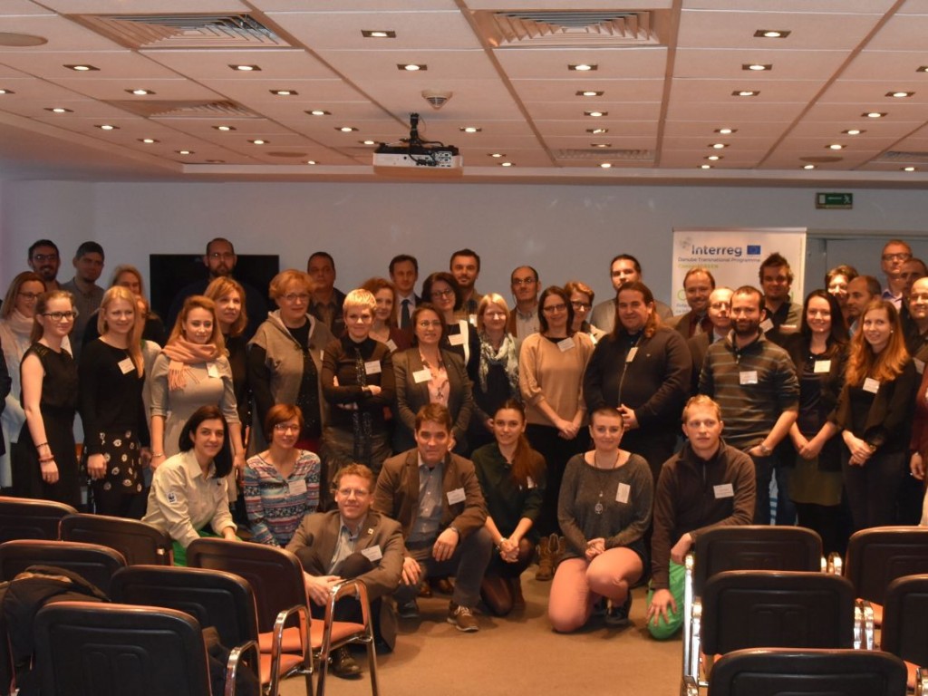
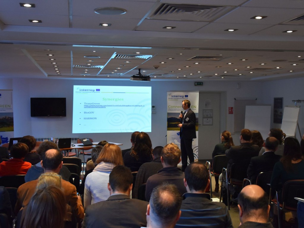
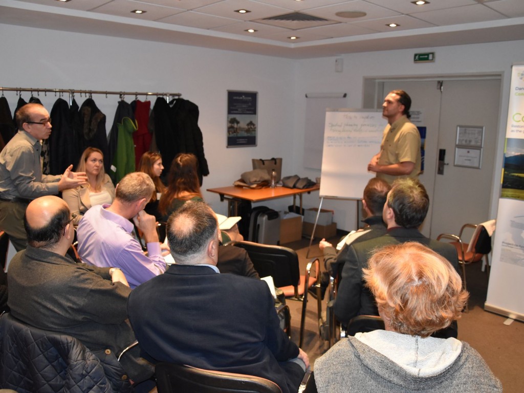
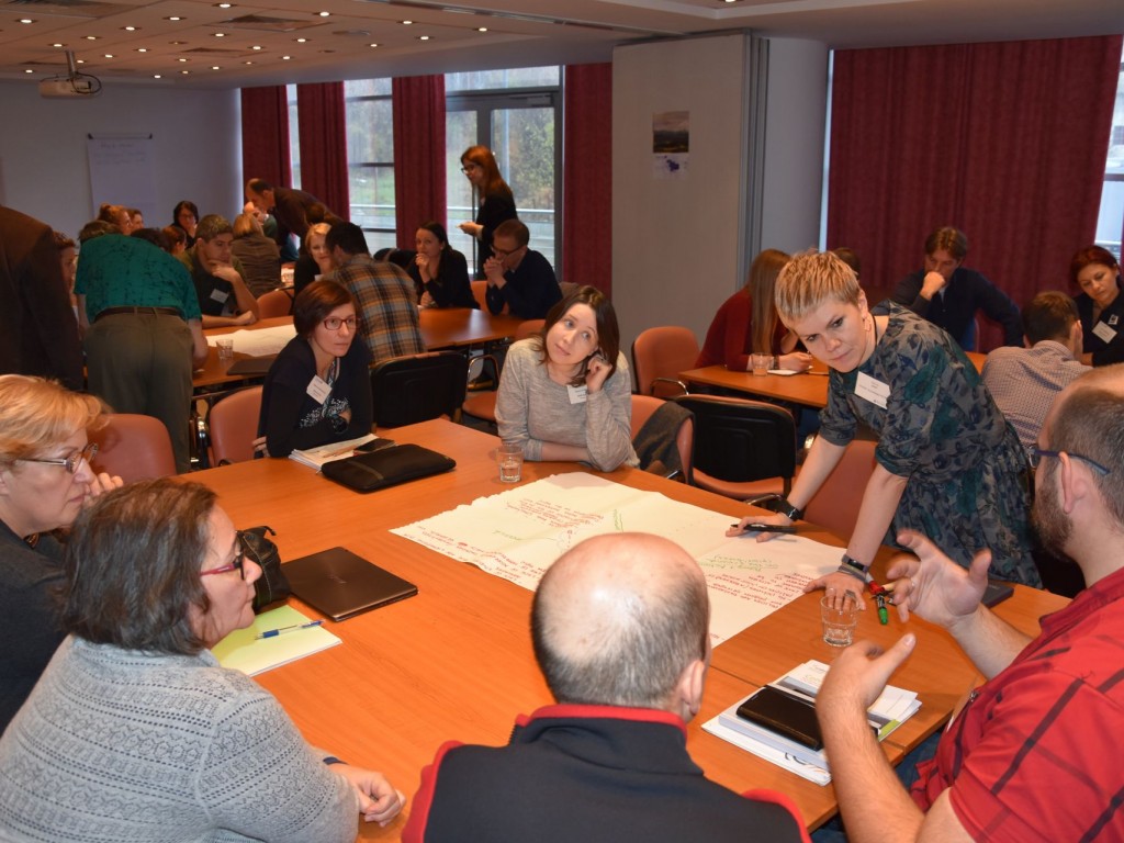
The official launch of the ConnectGREEN project enjoyed a vivid presence at the kick-off event hosted by WWF Romania in Bucharest, 20’th of November. Around 80 key stakeholders at international level and project partners from the Danube-Carpathian region joined to discuss different topics related to the main objective of the project: restoring and managing ecological corridors in Carpathian Mountains while minimising the conflicts between infrastructure/regional development and nature conservation.
“Linear infrastructure, roads and railways construction, unlike natural development, impacts the basic ecosystems that we depend on. We need to find solutions for the development, but in a way that does not undermine them. This is especially important in the age of climate change, where ecological networks are important for the resilience of habitat systems. In the Carpathian region we’re facing a considerable biodiversity loss and habitat fragmentation, by cutting in smaller and smaller pieces of the habitats we have”, declared Mr. Andreas Beckman, Managing Director of WWF-DCPO and host of the event, before opening of the speeches series.
The start of the project was warmly greeted by Mr. Harald Egerer, Head of the Secretariat of the Carpathian Convention: “Both TRANSGREEN and ConnectGREEN projects are embedded in one overall vision – the Carpathians as the green heart of Europe, that deserves to be preserved. (…) ConnectGREEN will build on past projects and support essential aspects of the work under the Carpathian Convention, including the international database and our work on the conservation and management of large carnivores under the Carpathian Convention”. According to Mr. Egerer, the Carpathian Convention will officially endorse some outputs of the project – such the Carpathian-wide Strategy on ecological corridors, in order to make project results more sustainable and long lasting.
“ConnectGREEN is a must to have project and it is the first time in our region when nature conservation and spatial planning work closely together to find practical solutions for preserving our natural capital in the jungle of rapid and massive economic development”, said Mr. Cristian Remus Papp, the Project coordinator and Wildlife and Landscape National Manager at WWF Romania. He also emphasized the importance of securing viable populations of large carnivores in the Carpathians by reducing the impact on their natural habitat. Mr Papp introduced the project aim and concrete objectives for partners from all the 5 countries participating in the project (Czech Republic, Slovakia, Hungary, Romania and Serbia):
- Developing innovative solutions and guidance to identify ecological corridors in a harmonized way across the Carpathian eco-region.
- Minimising conflicts between nature conservation and spatial planning
- Engaging key stakeholders as protected area managers, conservationists and spatial planners in an integrated approach for strengthening the capacity to identify and manage ecological corridors.
An integrated approach to harmonize conservation and spatial planning
In a keynote speech, Mr. Mircea Vergheleț, Head of the Piatra Craiului National Park Administration, explained the role of the protected areas and the importance of ecological connectivity, as well as the challenges in identifying and securing the movement corridors for wildlife. He described the importance of the Carpathian Network of the Protected Areas in this respect.
But how can we use the spatial planning as a tool in preserving the ecological connectivity? A first answer came from Mr. Rastislav Stanik, representative of Slovak Environment Agency (SEA), who described the concept of spatial planning and also its strengths and weaknesses in addressing the preservation of ecological corridors.
The challenges and the opportunities from the perspective of spatial planning were further detailed by Mr. Lazaros Georgiadis, biologist and Steering Group Member at Infra Eco Network Europe (IENE), who also focused on how to harmonize conservation and spatial planning by an integrated approach. Mr Georgiadis further gave as example the mitigation measures successfully applied in Greece to Egnatia Highway, from the classical tunnels and viaducts over the valleys to modern solutions as fauna underpasses, ecoducts, landscapes bridges and strong fences. In his opinion, if the appropriate measures were included in the initial phase, the delays would be avoided and the benefit for the development and economy should come much earlier.
Good lessons from other green areas of Europe
During the second session of the event, the associated partners of the project shared their valuable experience with preserving ecological connectivity in the Alps, in the Danube River Basin and Dinarides mountains. A good set of recommendations and ”lessons learnt” were delivered by representatives of Alpine Network of Protected Areas (ALPARC), Danubeparks and Parks Dinarides.
All shared experience and recommendations will be taken into account by ConnectGREEN project partners when creating the new Carpathian-wide methodology, which will be implemented in 4 transnational relevant pilot sites: 1. Piatra Craiului National Park/ Bucegi Nature Park (Romania); 2. Apuseni-SW Carpathians (Romania)/ National Park Djerdap (Serbia); 3. Western Carpathians (Czech Republic – Slovakia) and 4. Bükk National Park (Hungary)/ Cerová vrchovina Protected Landscape Area (Slovakia).
All partners joined for the second day of the kick off event in an effort to identify the Strengths, Weaknesses, Opportunities, Threats, but also the main Expectations from the project. This comprehensive and highly intense SWOT(E) analysis was meant to create a realistic context for strengthening the next steps of the project, that will put together specialists with very different backgrounds and from very different fields of activity.
“We have a great potential on board! For me it was a very good start for our cooperation. I love people and networks gathered around tasks that will hopefully bring some improvement to the environment”, concluded at the end of the day Ms Hildegard Meyer, from WWF International Danube-Carpathian Programme.
For further information, please check the Gallery (photos at the event) and the Library (speakers presentations), or contact Mr. Cristian Remus Papp, cpapp@wwfdcp.ro